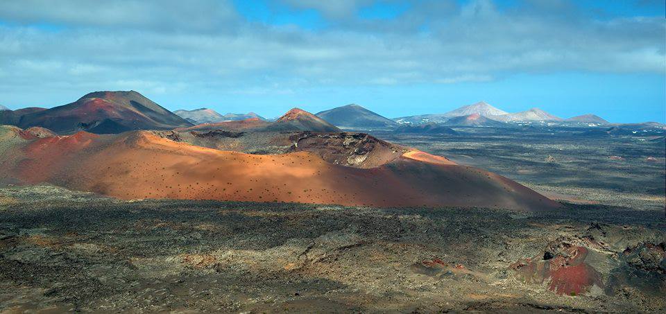
Of the 13 islands of the Canaries, Lanzarote is by far the most dramatic and contains the biggest scars of volcanic activity. This volcanic past is best observed at Timanfaya National Park located on the northwestern portion of the island. During a large eruption lasting from 1730 to 1736 a blanket of voluminous and fast-flowing lava was deposited from 24 vents covering an area of 174 square km (over 23% of the island). Nowadays the area gives the impression of visiting Mars because of its bright red and orange colors, which offers a deep contrast with the black beaches and turquoise sea. The island's native name is actually Titerro(y)gatra which probably translates as the red mountains.
Rows of Strombolian cones are seen as a reminder that the island is in a stage of rejuvenation. Most of the landscape is pockmarked by concentrations of over 25 craters and 100 cones. Areas that are lava-free and where vegetation can grow are called ‘tabaibal’. Due to the low precipitation and frost free climate on Lanzarote the solidified lava has not eroded and appears as if a fresh lava flow was deposited yesterday. However, the rest of the island has eroded significantly, especially in comparison to the other Canaries (http://
Alfred Wegener visited the island in 1912, only months after presenting his theory on continental drift. He showed how the island of Lanzarote fitted in his theory. In their formation the Canaries display similarities with the Hawaiian Island chain. It starts with a submarine stage followed by shieldbuilding, decline, erosion and rejuvenation. This process started around 180-150 million years ago during the first stage of opening of the Atlantic Ocean. After this multiple phases of volcanism followed. Volcanism is also connected to the active deformation of the Atlas Mountains of Morocco.
Only a small portion of the Timanfaya National Park is accessible and you are not allowed to use your own transportation. Access is controlled to protect the flora and fauna. If you ever visit the park be sure to stop at a restaurant located in the crater of Islote de Hilario where meat is barbequed above a 6m deep hole in the ground (350° C). The last eruption at Timanfaya occurred in 1824 when three small vent poured out a small lava flow.
Lanzarote is also home to the 15th longest lava tube (or tunnel) in the world. It extends from the base of 609m high Monte Corona 8km where it ends abruptly in a large chamber a mere 64m below sea level. Tubes as this one form in a flow of pahoehoe lava emanated from a lateral vent. It is very likely that after the lava tube reached the sea it stopped.
Image: Luc Viatour. Timanfaya National Park.
References:
http://www.volcano.si.edu/
http://
http://


No comments:
Post a Comment